File Details |
|
| File Size | 8.5 MB |
|---|---|
| License | Commercial Demo, $22.95 |
| Operating System | Windows 2000/9x/Server 2003/XP |
| Date Added | June 17, 2009 |
| Total Downloads | 127 |
| Publisher | Pretek, Inc. |
| Homepage | RoboGEO |
Publisher's Description
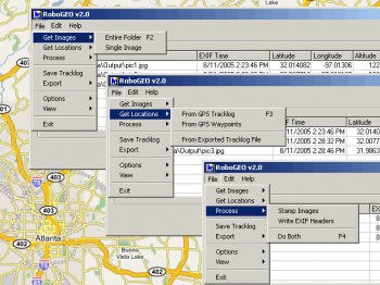
RoboGEO will geocode digital images with latitude, longitude, and altitude information. RoboGEO stamps this information onto the actual image and writes it to the JPG's EXIF headers, allowing you to permanently geocode and link the digital photo to the GPS coordinates. Now you can know where a given photo was taken. Create webpages using Google Maps or export to MapPoint. Directly supports Garmin GPS units (USB or COM), but no GPS is required. Geocode from a GPS tracklog or waypoints. Import GPX or G7ToWin files for interfacing with other GPS makes and models.
